
Cross-Country Weather Werfenweng
Werfenweng Valley

© GeoSphere Austria
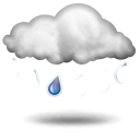
light rain or drizzle
7 °C
min 6 °C
max 12 °C
max 12 °C
Today, 24 Apr 2025: Fairly sunny with scattered clouds. Showers will be possible towards evening.
Current conditions
Morning
light rain or drizzle
8 °CRain: 2 l/m2Fresh snow: 0 cmWind direction: WestWind speed: 4 km/hStorm risk: 5 %Fog risk: 5 %Rain risk: 2 %Noon
 light rain or drizzle
11 °CRain: 1 l/m2Fresh snow: 0 cmWind direction: North-WestWind speed: 11 km/hStorm risk: 0 %Fog risk: 10 %Rain risk: 1 %Evening
light rain or drizzle
9 °CRain: 0 l/m2Fresh snow: 0 cmWind direction: North-WestWind speed: 4 km/hStorm risk: 0 %Fog risk: 10 %Rain risk: 0 %
Weather Stations nearby
- Werfenweng Summit
- 1,900 m
- Werfenweng Valley
- 1,000 m
- Werfenweng
- 702 m
Advertisement
Advertisement