
Today's weather at Hintertux Glacier • 9 Days Forecast
Hintertux Summit

© GeoSphere Austria
partly light snowfall
-3 °C
min -4 °C
max -1 °C
max -1 °C
Today, 15 Apr 2025: Partly sunny in the morning, gradually becoming cloudy in the afternoon.
Current conditions
Morning
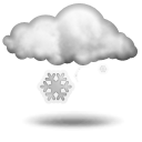 light snowfall
-3 °CRain: 1 l/m2Fresh snow: 1 cmWind direction: SouthWind speed: 47 km/hStorm risk: 0 %Fog risk: 80 %Rain risk: 1 %Noon
partly light snowfall
-2 °CRain: 2 l/m2Fresh snow: 2 cmWind direction: South-WestWind speed: 61 km/hStorm risk: 15 %Fog risk: 70 %Rain risk: 2 %Evening
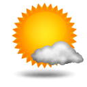 mostly sunny
-3 °CRain: 0 l/m2Fresh snow: 0 cmWind direction: South-WestWind speed: 50 km/hStorm risk: 20 %Fog risk: 0 %Rain risk: 0 %
Weather Stations nearby
- Hintertux Summit
- 3,250 m
- Hintertux Valley
- 1,500 m
Advertisement
Advertisement